Home/Curriculum resources/Learning about Country/Place/Case Study 3: Uluru
Learning Areas:
English, Humanities and Social Sciences, The Arts
Year levels:
Level 3, Level 4

Case Study 3: Uluru
This case study is a part of the Learning about Country/Place resource.
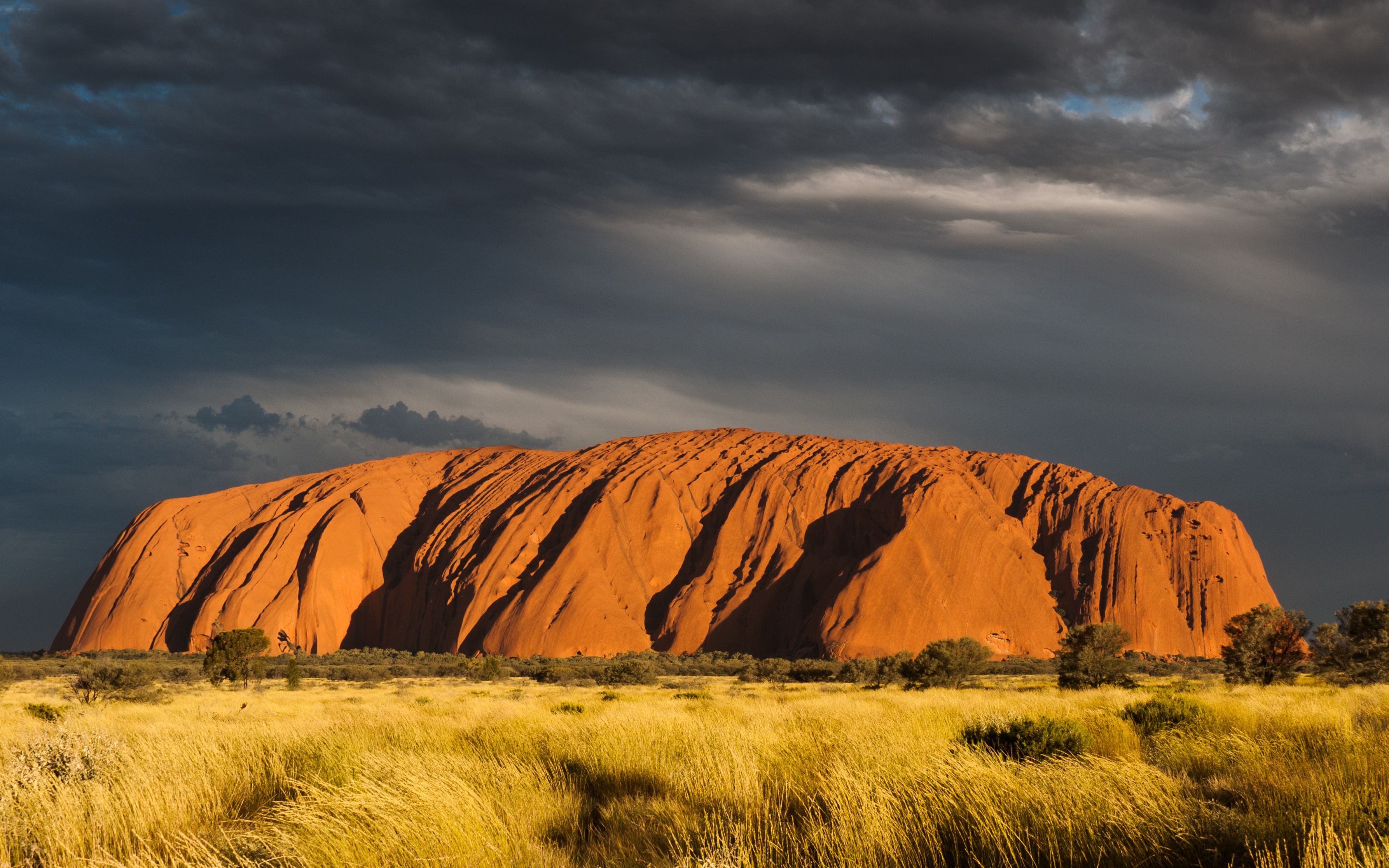
Uluru (Ayers Rock), Sunset. Photographer: Weyf. Source: Wikimedia Commons. Used under licence: CC0 1.0

Case Study 3: Uluru
Uluru is perhaps the best-known landmark in Australia, it is sacred to the Pitjantjatjara and Yankunytjatjara Anangu Peoples. Uluru is listed as both cultural and natural property on UNESCO’s world heritage list. Standing at 348 metres high, with a circumference of 9.4 km at its base, Uluru is made of sandstone approximately half a billion years old. Uluru is often called the Aboriginal Heart of Australia 0 .
Uluru has continued to serve as a lightning rod for political discussions, as in recent times, it serves as both a sacred site and a tourist destination – which brings conflicting interests to the area daily 0 . The name of the large rock formation itself shows this political upheaval; changing race relations within Australia.
Initially labelled ‘Ayers Rock’ in 1873 by the surveyor William Gosse, a dual naming policy saw it renamed ‘Ayers Rock / Uluru’ and more recently in 2002, it has had these names flipped being referred to as 'Uluru / Ayers Rock’ 0 . In 1985, the Hawk Government transferred the title of Uluru (Ayers Rock) and Kata Juta (the Olgas) to the Anangu People, which itself warranted a media furore 0 . The landmarks most recently lent its name to the Uluru Statement from the Heart.
To climb or not to climb? That WAS the question.

Figure 1: Uluru Ayers Rock Sunrise. Photographer: Stonechenrock. Source: Wikimedia Commons. Used under licence: CC BY-SA 4.0
Another key quandary at Uluru was whether or not to climb the rock, something that had previously become common practice for people visiting the site 0 . Since the 1930’s, visitors to Uluru had been able to make the climb to the top of the rock. As Uluru was considered sacred, climbing was rarely permitted by Tjukurpa, Anangu law and culture. In 1985, when ownership of the Uluru-Kata Tjuta was returned to Anangu, discussions around whether to continue permitting the climb began. It was not until the 1990’s that signs and information was put up around Uluru that asked tourists to not climb and explained the cultural and spiritual significance to the peoples of this Country.
Finally, in 2010, the Park’s Management Plan mapped out the movement towards closing the climb and debate raged fiercely about the rights of all Australians, and visitors, to access Uluru. In 2017, after visitors seeking to climb Uluru had dropped so steeply, the decision was made to signal the closure of the climb.
For the Anangu People, Uluru and the surrounding sites of ceremonial importance is ongoing confirmation of Tjukurpa (The Dreaming) 0 , which is not understood as a static time in the past, but rather:
"Time is not linear. It doesn’t start at a point, it doesn’t finish at a point. For us, time is circular” 0 .
Kutcha Edwards, Mutti Mutt
The rocks and stones around Uluru are understood as sentient ancestors and a living record of history and culture.
“We have no books, our history was not written by people with pen and paper. It is in the land, the footprints of our Creation Ancestors are on the rocks.”
Nganyinytja, Pitjantjatjara Elder (1988)

Related case studies within this resources:
Case Study 1: Martuwarra / Mardoowarra (Fitzroy River)
The Martuwarra / Mardoowarra (Fitzroy River) is an illustration of connection to Country for multiple Aboriginal groups.

Case Study 2: Gulaga Mountain (Mount Dromadery)
Gulaga Mountain (Mount Dromadery) is an illustration of connection to Country for the Yuin people.

Case Study 4: The Torres Strait Islander Seascape
Torres Strait Islander Peoples have a deep cultural and natural connection to the seascape that surrounds the hundreds of islands that make up the Torres Strait.